Geolocate

Haimen topographic map

Click on the map to display elevation.

About this map

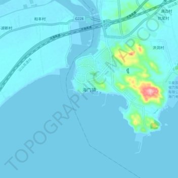
Name: Haimen topographic map, elevation, terrain.

Location: Haimen, Shantou, Guangdong Province, China (23.14451 116.57418 23.22451 116.65418)

Average elevation: 33 ft

Minimum elevation: -10 ft

Maximum elevation: 571 ft

Gear up for your next adventure:

🪶LED Camping Lantern - Bright lantern for camp lighting
🦶Hiking Gaiters - Keep debris and water out of your boots
🌐World Map Poster - Decorative world maps with topographic info
🌡️Portable Weather Meter - Track weather conditions on the trail
Solar GPS Watches - Advanced multisport watches with built-in topographic maps

As an Amazon Associate, this site earns from qualifying purchases at no extra cost to you.