Geolocate

Florstadt topographic map

Click on the map to display elevation.

About this map

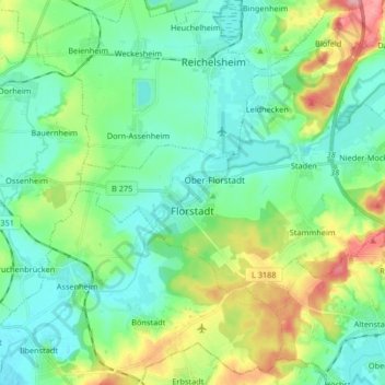
Name: Florstadt topographic map, elevation, terrain.

Location: Florstadt, Wetteraukreis, Hesse, 61197, Germany (50.28951 8.81705 50.35510 8.98194)

Average elevation: 486 ft

Minimum elevation: 377 ft

Maximum elevation: 774 ft

Gear up for your next adventure:

🚗GPS Dash Cams - Record your scenic drives through mountain passes and canyons
🔦LED Headlamp - Bright and durable LED headlamp for night navigation
📶Satellite Messenger - Communication device off‑grid
Solar GPS Watches - Advanced multisport watches with built-in topographic maps
🩳Quick‑Dry Hiking Shorts - Comfortable and quick‑dry shorts for summer hiking

As an Amazon Associate, this site earns from qualifying purchases at no extra cost to you.