

Étalans topographic map
Click on the map to display elevation.
Étalans
Le village, s'élevant à 588 mètres d'altitude, est composé d'anciens quartiers ruraux, mais s'est développé en construisant des lotissements. Sur le territoire de la commune se trouvent des forêts de chasse, des champs, mais aussi un étang et le gouffre de Poudrey.
About this map
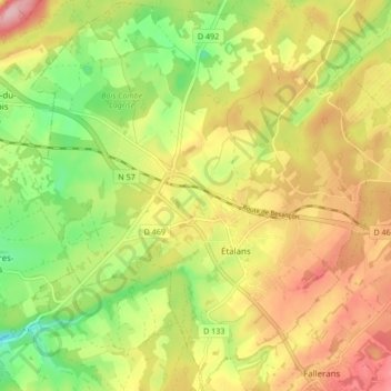
Name: Étalans topographic map, elevation, terrain.
Average elevation: 1,926 ft
Minimum elevation: 1,660 ft
Maximum elevation: 2,195 ft
Other topographic maps
Click on a map to view its topography, its elevation and its terrain.
Gouffre de Poudrey
France > Bourgogne-Franche-Comté > Doubs > Étalans > Puits de Poudrey
Average elevation: 1,877 ft