
Make a donation
Gear up for your next adventure:
As an Amazon Associate, this site earns from qualifying purchases at no extra cost to you.
Reutehöfe topographic map
Click on the map to display elevation.
Make a donation
Gear up for your next adventure:
As an Amazon Associate, this site earns from qualifying purchases at no extra cost to you.
About this map
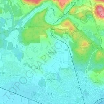
Name: Reutehöfe topographic map, elevation, terrain.
Average elevation: 1,398 ft
Minimum elevation: 1,293 ft
Maximum elevation: 1,752 ft
Make a donation
Gear up for your next adventure:
As an Amazon Associate, this site earns from qualifying purchases at no extra cost to you.
Other topographic maps
Click on a map to view its topography, its elevation and its terrain.
78315
Deutschland > Baden-Württemberg > Landkreis Konstanz > Radolfzell am Bodensee > Möggingen
Average elevation: 1,522 ft
Markelfingen
Deutschland > Baden-Württemberg > Landkreis Konstanz > Radolfzell am Bodensee
Im Kern zeigt sich Markelfingen als dicht bebaute, straßendorfartige Siedlung mit haufendorfartiger Erweiterung im Norden entlang des Mühlbachs/Mühlenbaches, der den Mindelsee in den Untersee entwässert. Die Durchgangsstraße (Radolfzeller Straße) trennt das seenahe Unterdorf vom höhergelegenen Oberdorf.…
Average elevation: 1,365 ft
Böhringen
Deutschland > Baden-Württemberg > Landkreis Konstanz > Radolfzell am Bodensee
Nach dem Ersten Weltkrieg litt auch die Böhringer Bevölkerung unter der Inflation, eine der radikalsten Geldentwertungen, die in der Hyperinflation des Jahres 1923 ihren Höhepunkt erreichte.
Average elevation: 1,381 ft