
Thank you for supporting this site ❤️
Make a donation
Make a donation
Gear up for your next adventure:
As an Amazon Associate, this site earns from qualifying purchases at no extra cost to you.
Untersiggenthal topographic map
Click on the map to display elevation.
Thank you for supporting this site ❤️
Make a donation
Make a donation
Gear up for your next adventure:
As an Amazon Associate, this site earns from qualifying purchases at no extra cost to you.
About this map
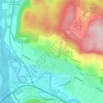
Name: Untersiggenthal topographic map, elevation, terrain.
Location: Untersiggenthal, Bezirk Baden, Aargau, Switzerland (47.48833 8.23285 47.51940 8.28009)
Average elevation: 1,394 ft
Minimum elevation: 1,056 ft
Maximum elevation: 1,962 ft
Thank you for supporting this site ❤️
Make a donation
Make a donation
Gear up for your next adventure:
As an Amazon Associate, this site earns from qualifying purchases at no extra cost to you.