
Montreuil Lake topographic map
Interactive map
Click on the map to display elevation.
About this map
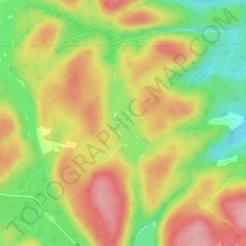
Name: Montreuil Lake topographic map, elevation, terrain.
Average elevation: 1,033 ft
Minimum elevation: 804 ft
Maximum elevation: 1,240 ft
Other topographic maps
Click on a map to view its topography, its elevation and its terrain.
Purdy Lake
Purdy Lake, Mattawan, Nipissing District, Northeastern Ontario, Ontario, Canada
Average elevation: 1,076 ft