
Thank you for supporting this site ❤️
Make a donation
Make a donation
Gear up for your next adventure:
As an Amazon Associate, this site earns from qualifying purchases at no extra cost to you.
Spangenberg topographic map
Click on the map to display elevation.
Thank you for supporting this site ❤️
Make a donation
Make a donation
Gear up for your next adventure:
As an Amazon Associate, this site earns from qualifying purchases at no extra cost to you.
About this map
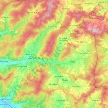
Name: Spangenberg topographic map, elevation, terrain.
Location: Spangenberg, Schwalm-Eder-Kreis, Hesse, 34286, Alemanha (51.06910 9.58246 51.17348 9.78113)
Average elevation: 1,227 ft
Minimum elevation: 577 ft
Maximum elevation: 1,919 ft
Thank you for supporting this site ❤️
Make a donation
Make a donation
Gear up for your next adventure:
As an Amazon Associate, this site earns from qualifying purchases at no extra cost to you.