
Thank you for supporting this site ❤️
Make a donation
Make a donation
Gear up for your next adventure:
As an Amazon Associate, this site earns from qualifying purchases at no extra cost to you.
A Graña topographic map
Click on the map to display elevation.
Thank you for supporting this site ❤️
Make a donation
Make a donation
Gear up for your next adventure:
As an Amazon Associate, this site earns from qualifying purchases at no extra cost to you.
About this map
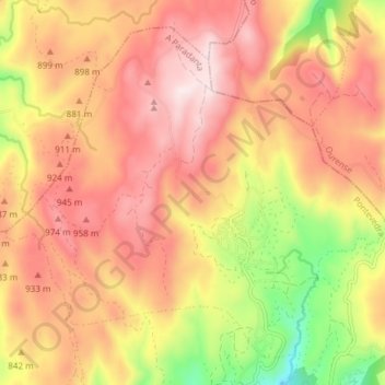
Name: A Graña topographic map, elevation, terrain.
Location: A Graña, Covelo, A Paradanta, Pontevedra, Galice, Espagne (42.30655 -8.36522 42.35424 -8.29011)
Average elevation: 2,759 ft
Minimum elevation: 1,749 ft
Maximum elevation: 3,438 ft
Thank you for supporting this site ❤️
Make a donation
Make a donation
Gear up for your next adventure:
As an Amazon Associate, this site earns from qualifying purchases at no extra cost to you.