
Thank you for supporting this site ❤️
Make a donation
Make a donation
Gear up for your next adventure:
As an Amazon Associate, this site earns from qualifying purchases at no extra cost to you.
Kotagala topographic map
Click on the map to display elevation.
Thank you for supporting this site ❤️
Make a donation
Make a donation
Gear up for your next adventure:
As an Amazon Associate, this site earns from qualifying purchases at no extra cost to you.
About this map
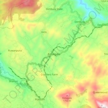
Name: Kotagala topographic map, elevation, terrain.
Location: Kotagala, Nuwara Eliya District, Central Province, Sri Lanka (6.88527 80.56906 6.96527 80.64906)
Average elevation: 4,354 ft
Minimum elevation: 3,097 ft
Maximum elevation: 6,129 ft
Thank you for supporting this site ❤️
Make a donation
Make a donation
Gear up for your next adventure:
As an Amazon Associate, this site earns from qualifying purchases at no extra cost to you.