Geolocate

Kaula topographic map

Click on the map to display elevation.

About this map

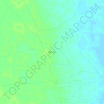
Name: Kaula topographic map, elevation, terrain.

Location: Kaula, Arege, Abadam, Borno, Nigeria (13.47870 13.36647 13.51870 13.40647)

Average elevation: 932 ft

Minimum elevation: 915 ft

Maximum elevation: 945 ft

Gear up for your next adventure:

🌡️Portable Weather Meter - Track weather conditions on the trail
GPS Sports Watch - GPS watch for running, hiking and training
📶Vehicle Signal Boosters - Improve reception in rural areas while driving to trailheads
🛏️Cold Weather Sleeping Bag - Warm sleeping bag for cold conditions
🎒Hydration Pack - Hands‑free water reservoir for long hikes

As an Amazon Associate, this site earns from qualifying purchases at no extra cost to you.