
Thank you for supporting this site ❤️
Make a donation
Make a donation
Gear up for your next adventure:
As an Amazon Associate, this site earns from qualifying purchases at no extra cost to you.
Ahraura topographic map
Click on the map to display elevation.
Thank you for supporting this site ❤️
Make a donation
Make a donation
Gear up for your next adventure:
As an Amazon Associate, this site earns from qualifying purchases at no extra cost to you.
About this map
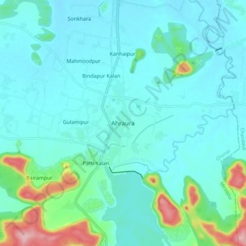
Name: Ahraura topographic map, elevation, terrain.
Location: Ahraura, Chunar, Mirzapur, Uttar Pradesh, 231300, India (24.97594 82.99298 25.05594 83.07298)
Average elevation: 377 ft
Minimum elevation: 285 ft
Maximum elevation: 827 ft
Thank you for supporting this site ❤️
Make a donation
Make a donation
Gear up for your next adventure:
As an Amazon Associate, this site earns from qualifying purchases at no extra cost to you.