
Coweta topographic map
Click on the map to display elevation.
About this map
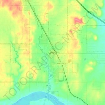
Name: Coweta topographic map, elevation, terrain.
Location: Coweta, Wagoner County, Oklahoma, 94429, United States (35.91248 -95.69086 35.99248 -95.61086)
Average elevation: 653 ft
Minimum elevation: 535 ft
Maximum elevation: 817 ft
Wagoner County trails, hiking, mountain biking, running and outdoor activities