
Thank you for supporting this site ❤️
Make a donation
Make a donation
Gear up for your next adventure:
As an Amazon Associate, this site earns from qualifying purchases at no extra cost to you.
Columbe topographic map
Click on the map to display elevation.
Thank you for supporting this site ❤️
Make a donation
Make a donation
Gear up for your next adventure:
As an Amazon Associate, this site earns from qualifying purchases at no extra cost to you.
About this map
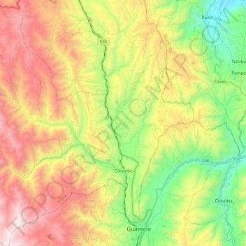
Name: Columbe topographic map, elevation, terrain.
Location: Columbe, Colta, Chimborazo, 2320002, Ecuador (-1.94756 -78.85444 -1.75171 -78.66704)
Average elevation: 11,217 ft
Minimum elevation: 8,911 ft
Maximum elevation: 14,019 ft
Thank you for supporting this site ❤️
Make a donation
Make a donation
Gear up for your next adventure:
As an Amazon Associate, this site earns from qualifying purchases at no extra cost to you.