
Thank you for supporting this site ❤️
Make a donation
Make a donation
Gear up for your next adventure:
As an Amazon Associate, this site earns from qualifying purchases at no extra cost to you.
Burnenville topographic map
Click on the map to display elevation.
Thank you for supporting this site ❤️
Make a donation
Make a donation
Gear up for your next adventure:
As an Amazon Associate, this site earns from qualifying purchases at no extra cost to you.
About this map
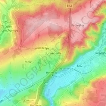
Name: Burnenville topographic map, elevation, terrain.
Location: Burnenville, Malmedy, Verviers, Luik, Wallonië, 4960, België (50.40649 5.97771 50.44649 6.01771)
Average elevation: 1,355 ft
Minimum elevation: 1,024 ft
Maximum elevation: 1,690 ft
Thank you for supporting this site ❤️
Make a donation
Make a donation
Gear up for your next adventure:
As an Amazon Associate, this site earns from qualifying purchases at no extra cost to you.