Geolocate

Eldora topographic map

Click on the map to display elevation.

About this map

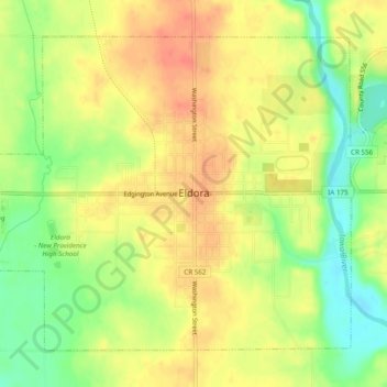
Name: Eldora topographic map, elevation, terrain.

Location: Eldora, Hardin County, Iowa, 50627, United States (42.34618 -93.12816 42.37504 -93.08003)

Average elevation: 1,033 ft

Minimum elevation: 935 ft

Maximum elevation: 1,109 ft

Hardin County trails, hiking, mountain biking, running and outdoor activities

Other topographic maps

Click on a map to view its topography, its elevation and its terrain.

Garden City

United States > Iowa > Hardin County

Average elevation: 1,178 ft

Gifford

United States > Iowa > Hardin County

Average elevation: 971 ft

Gear up for your next adventure:

🕶️Glacier Sunglasses - Side shields to protect eyes from high-altitude snow glare
🪶Paracord Bracelet - Survival bracelet with built‑in tools
🥘Titanium Cookware - Durable, featherlight pots and pans for backpacking
🥾Women's Hiking Boots - Top-rated trail boots with ankle support and superior grip
🗺️NatGeo Topo Maps - High-quality waterproof printed topographic maps of US Parks

As an Amazon Associate, this site earns from qualifying purchases at no extra cost to you.