Geolocate

Etchingham topographic map

Click on the map to display elevation.

About this map
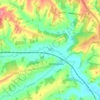
Name: Etchingham topographic map, elevation, terrain.

Location: Etchingham, Rother, East Sussex, England, United Kingdom (50.99364 0.39071 51.03614 0.46220)

Average elevation: 151 ft

Minimum elevation: 30 ft

Maximum elevation: 354 ft

Gear up for your next adventure:

🧢Sun Protection Hats - Wide-brimmed and UPF-rated hats for high-altitude sun safety
🧼Biodegradable Camping Soap - Eco‑friendly soap for outdoor hygiene
🧭Outdoor Navigation Book - Learn advanced navigation skills
🥇GPS Hiking Watch - Multi‑sport GPS watch with navigation and trail tracking
🌡️Handheld Weather Meters - Measure wind, temp, and pressure for safe mountain travel

As an Amazon Associate, this site earns from qualifying purchases at no extra cost to you.