
Dell topographic map
Click on the map to display elevation.
About this map
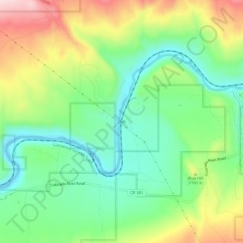
Name: Dell topographic map, elevation, terrain.
Location: Dell, Eagle County, Colorado, United States (39.86554 -106.87643 39.90554 -106.83643)
Average elevation: 6,860 ft
Minimum elevation: 6,480 ft
Maximum elevation: 7,497 ft
Eagle County trails, hiking, mountain biking, running and outdoor activities