
Thank you for supporting this site ❤️
Make a donation
Make a donation
Gear up for your next adventure:
As an Amazon Associate, this site earns from qualifying purchases at no extra cost to you.
Xixia District topographic map
Click on the map to display elevation.
Thank you for supporting this site ❤️
Make a donation
Make a donation
Gear up for your next adventure:
As an Amazon Associate, this site earns from qualifying purchases at no extra cost to you.
About this map
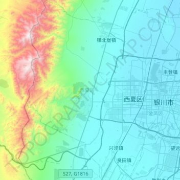
Name: Xixia District topographic map, elevation, terrain.
Location: Xixia District, Yinchuan City, Ningxia, 750021, China (38.31238 105.83883 38.71016 106.21805)
Average elevation: 4,711 ft
Minimum elevation: 3,615 ft
Maximum elevation: 10,443 ft
Thank you for supporting this site ❤️
Make a donation
Make a donation
Gear up for your next adventure:
As an Amazon Associate, this site earns from qualifying purchases at no extra cost to you.