Geolocate

Clifton topographic map

Click on the map to display elevation.

About this map

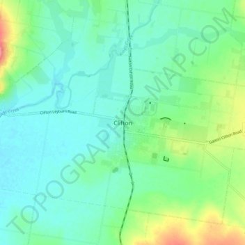
Name: Clifton topographic map, elevation, terrain.

Location: Clifton, Toowoomba Regional, Queensland, 4361, Australia (-27.97004 151.86584 -27.89004 151.94584)

Average elevation: 1,470 ft

Minimum elevation: 1,401 ft

Maximum elevation: 1,663 ft

Other topographic maps

Click on a map to view its topography, its elevation and its terrain.

Clifton

Australia > Queensland > Clifton

Average elevation: 1,529 ft

Gear up for your next adventure:

🥾Men's Hiking Boots - Durable, waterproof footwear for rugged terrain and steep inclines
🌡️Handheld Weather Meters - Measure wind, temp, and pressure for safe mountain travel
📡GPS Antenna Upgrade - Enhance GPS reception in remote terrain
🕶️GPS Smartphone Mount - Secure mount for phone navigation
🧤Hiking Gloves - Protective gloves for rugged trails

As an Amazon Associate, this site earns from qualifying purchases at no extra cost to you.