Geolocate

Ngatea topographic map

Click on the map to display elevation.

About this map

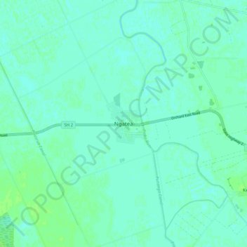
Name: Ngatea topographic map, elevation, terrain.

Location: Ngatea, Hauraki District, Waikato, 3503, New Zealand (-37.31572 175.45165 -37.23572 175.53165)

Average elevation: 16 ft

Minimum elevation: 3 ft

Maximum elevation: 36 ft

Gear up for your next adventure:

🧯Emergency Survival Kit - All‑in‑one survival essentials for the backcountry
🎒Gear Packing Cubes - Organize your backpack efficiently
🪄Magnetic Compass - Accurate compass for navigation
🧼Biodegradable Camping Soap - Eco‑friendly soap for outdoor hygiene
🪶LED Camping Lantern - Bright lantern for camp lighting

As an Amazon Associate, this site earns from qualifying purchases at no extra cost to you.