
Carrollton topographic map
Click on the map to display elevation.
About this map
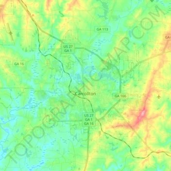
Name: Carrollton topographic map, elevation, terrain.
Location: Carrollton, Carroll County, Georgia, United States (33.53979 -85.18621 33.63339 -85.01439)
Average elevation: 1,079 ft
Minimum elevation: 942 ft
Maximum elevation: 1,391 ft
Carroll County trails, hiking, mountain biking, running and outdoor activities
Other topographic maps
Click on a map to view its topography, its elevation and its terrain.