
Thank you for supporting this site ❤️
Make a donation
Make a donation
Gear up for your next adventure:
As an Amazon Associate, this site earns from qualifying purchases at no extra cost to you.
Dabajianshan topographic map
Click on the map to display elevation.
Thank you for supporting this site ❤️
Make a donation
Make a donation
Gear up for your next adventure:
As an Amazon Associate, this site earns from qualifying purchases at no extra cost to you.
About this map
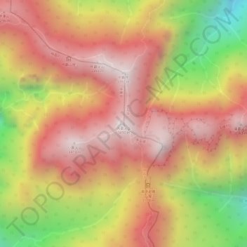
Name: Dabajianshan topographic map, elevation, terrain.
Location: Dabajianshan, Tai'an, Miaoli County, Taiwan (24.45769 121.25795 24.45779 121.25805)
Average elevation: 9,997 ft
Minimum elevation: 8,140 ft
Maximum elevation: 11,070 ft
Thank you for supporting this site ❤️
Make a donation
Make a donation
Gear up for your next adventure:
As an Amazon Associate, this site earns from qualifying purchases at no extra cost to you.