
Thank you for supporting this site ❤️
Make a donation
Make a donation
Gear up for your next adventure:
As an Amazon Associate, this site earns from qualifying purchases at no extra cost to you.
Mbelei topographic map
Click on the map to display elevation.
Thank you for supporting this site ❤️
Make a donation
Make a donation
Gear up for your next adventure:
As an Amazon Associate, this site earns from qualifying purchases at no extra cost to you.
About this map
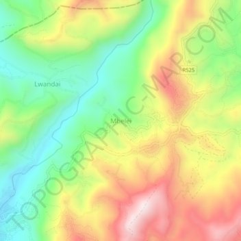
Name: Mbelei topographic map, elevation, terrain.
Location: Mbelei, Bumbuli, Tanga Region, Northern Zone, Tanzania (-4.84975 38.36879 -4.80975 38.40879)
Average elevation: 4,751 ft
Minimum elevation: 3,858 ft
Maximum elevation: 5,850 ft
Thank you for supporting this site ❤️
Make a donation
Make a donation
Gear up for your next adventure:
As an Amazon Associate, this site earns from qualifying purchases at no extra cost to you.