
Thank you for supporting this site ❤️
Make a donation
Make a donation
Gear up for your next adventure:
As an Amazon Associate, this site earns from qualifying purchases at no extra cost to you.
Khatoo topographic map
Click on the map to display elevation.
Thank you for supporting this site ❤️
Make a donation
Make a donation
Gear up for your next adventure:
As an Amazon Associate, this site earns from qualifying purchases at no extra cost to you.
About this map
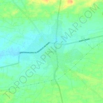
Name: Khatoo topographic map, elevation, terrain.
Location: Khatoo, Danta Ramgarh Tehsil, Sikar, Rajasthan, 332602, India (27.34595 75.38353 27.38595 75.42353)
Average elevation: 1,493 ft
Minimum elevation: 1,453 ft
Maximum elevation: 1,562 ft
Thank you for supporting this site ❤️
Make a donation
Make a donation
Gear up for your next adventure:
As an Amazon Associate, this site earns from qualifying purchases at no extra cost to you.