Geolocate

Hadleigh topographic map

Click on the map to display elevation.

About this map

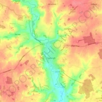
Name: Hadleigh topographic map, elevation, terrain.

Location: Hadleigh, Babergh, Suffolk, England, United Kingdom (52.02726 0.90728 52.07018 1.01588)

Average elevation: 167 ft

Minimum elevation: 36 ft

Maximum elevation: 253 ft

Other topographic maps

Click on a map to view its topography, its elevation and its terrain.

Sudbury

United Kingdom > England > Suffolk > Babergh > Sudbury

Average elevation: 177 ft

Gear up for your next adventure:

🎒Waterproof Dry Bags - Keep your electronics and maps dry inside your pack
🥾Hiking Shoes - Durable and comfortable shoes for trail hiking
🧭Compass with Lanyard - Easy‑carry compass for navigation
🔋Solar Power Banks - Keep your GPS and phone charged in remote wilderness areas
🪶Wildlife Field Guides - Learn animal tracking and species ID

As an Amazon Associate, this site earns from qualifying purchases at no extra cost to you.