Geolocate

Al-Khatatba topographic map

Click on the map to display elevation.

About this map

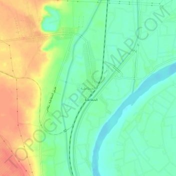
Name: Al-Khatatba topographic map, elevation, terrain.

Location: Al-Khatatba, Al Minufiya, Egypt (30.33952 30.79766 30.37952 30.83766)

Average elevation: 75 ft

Minimum elevation: 0 ft

Maximum elevation: 194 ft

Other topographic maps

Click on a map to view its topography, its elevation and its terrain.

Sadat City

Egypt > Al Minufiya

Average elevation: 102 ft

Gear up for your next adventure:

🥘Titanium Cookware - Durable, featherlight pots and pans for backpacking
❄️Traction Cleats - Prevent slips on icy trails during winter hikes
🎒Trail Energy Bars - High‑calorie bars for hiking energy
Backpacking Tent - Lightweight and durable tent for multi‑day hikes
🎒Day Hiking Backpack - Lightweight backpack perfect for day trips and outdoor adventures

As an Amazon Associate, this site earns from qualifying purchases at no extra cost to you.