
Thank you for supporting this site ❤️
Make a donation
Make a donation
Gear up for your next adventure:
As an Amazon Associate, this site earns from qualifying purchases at no extra cost to you.
Lambo topographic map
Click on the map to display elevation.
Thank you for supporting this site ❤️
Make a donation
Make a donation
Gear up for your next adventure:
As an Amazon Associate, this site earns from qualifying purchases at no extra cost to you.
About this map
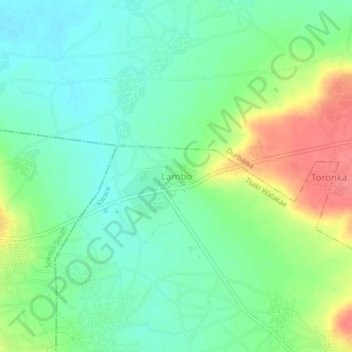
Name: Lambo topographic map, elevation, terrain.
Location: Lambo, Tsaki Walakae, Kware, Sokoto State, Nigeria (13.03193 5.28624 13.07193 5.32624)
Average elevation: 883 ft
Minimum elevation: 807 ft
Maximum elevation: 1,017 ft
Thank you for supporting this site ❤️
Make a donation
Make a donation
Gear up for your next adventure:
As an Amazon Associate, this site earns from qualifying purchases at no extra cost to you.