
Boshof topographic map
Click on the map to display elevation.
About this map
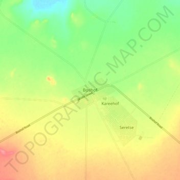
Name: Boshof topographic map, elevation, terrain.
Average elevation: 4,108 ft
Minimum elevation: 3,990 ft
Maximum elevation: 4,236 ft
Other topographic maps
Click on a map to view its topography, its elevation and its terrain.
Tokologo Ward 3
South Africa > Free State > Lejweleputswa District Municipality > Tokologo Local Municipality
Average elevation: 3,983 ft
Tokologo Ward 2
South Africa > Free State > Lejweleputswa District Municipality > Tokologo Local Municipality
Average elevation: 4,117 ft
Tokologo Ward 4
South Africa > Free State > Lejweleputswa District Municipality > Tokologo Local Municipality
Average elevation: 4,131 ft