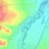
Martin topographic map
Click on the map to display elevation.
Martin
Martin lies at an altitude of 395 metres (1,296 ft) above sea level and covers an area of 67.74 square kilometres (26.2 sq mi). It is located in northern Slovakia, in the Turiec Basin, just south of the confluence of the Turiec river with Váh. Mountain ranges in the proximity of the city are Malá Fatra (Lesser Fatra) and Vel’ká Fatra (Greater Fatra); more to the south are the Žiar and Kremnica Mountains. The nearest major cities are Žilina, 30 kilometres (19 mi) away to the north-west, Banská Bystrica, 60 kilometres (37 mi) away to the south-east and capital Bratislava, 230 kilometres (143 mi) to the south-west (by road). Martin has 10 boroughs: Jahodníky, Ľadoveň, Stred, Sever, Košúty, Podháj, Stráne, Priekopa, Tomčany, and Záturčie.
About this map

Name: Martin topographic map, elevation, terrain.
Average elevation: 1,588 ft
Minimum elevation: 1,217 ft
Maximum elevation: 3,848 ft
Other topographic maps
Click on a map to view its topography, its elevation and its terrain.