
Thank you for supporting this site ❤️
Make a donation
Make a donation
Gear up for your next adventure:
As an Amazon Associate, this site earns from qualifying purchases at no extra cost to you.
Villacollo topographic map
Click on the map to display elevation.
Thank you for supporting this site ❤️
Make a donation
Make a donation
Gear up for your next adventure:
As an Amazon Associate, this site earns from qualifying purchases at no extra cost to you.
About this map
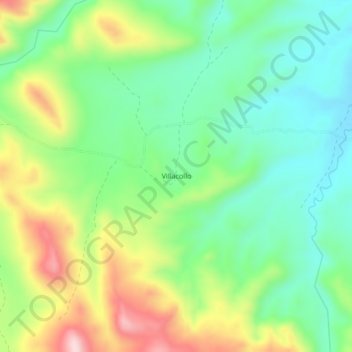
Name: Villacollo topographic map, elevation, terrain.
Location: Villacollo, Huanuni, Pantaleón Dalence, Oruro, Bolivia (-18.30579 -66.72958 -18.26579 -66.68958)
Average elevation: 13,681 ft
Minimum elevation: 13,330 ft
Maximum elevation: 14,301 ft
Thank you for supporting this site ❤️
Make a donation
Make a donation
Gear up for your next adventure:
As an Amazon Associate, this site earns from qualifying purchases at no extra cost to you.