
Thank you for supporting this site ❤️
Make a donation
Make a donation
Gear up for your next adventure:
As an Amazon Associate, this site earns from qualifying purchases at no extra cost to you.
Masupu topographic map
Click on the map to display elevation.
Thank you for supporting this site ❤️
Make a donation
Make a donation
Gear up for your next adventure:
As an Amazon Associate, this site earns from qualifying purchases at no extra cost to you.
About this map
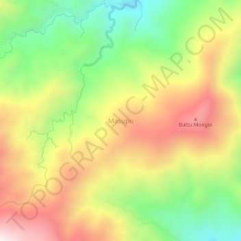
Name: Masupu topographic map, elevation, terrain.
Location: Masupu, Mamasa, West Sulawesi, Sulawesi, Indonesia (-3.00449 119.49039 -2.96449 119.53039)
Average elevation: 5,256 ft
Minimum elevation: 3,816 ft
Maximum elevation: 6,804 ft
Thank you for supporting this site ❤️
Make a donation
Make a donation
Gear up for your next adventure:
As an Amazon Associate, this site earns from qualifying purchases at no extra cost to you.