Geolocate

Kokopo topographic map

Click on the map to display elevation.

About this map

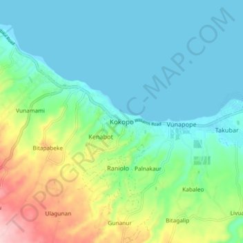
Name: Kokopo topographic map, elevation, terrain.

Location: Kokopo, East New Britain, Islands Region, Papua New Guinea (-4.38322 152.22867 -4.30322 152.30867)

Average elevation: 171 ft

Minimum elevation: -3 ft

Maximum elevation: 669 ft

Gear up for your next adventure:

🍳Camping Cook Set - Complete cookware for outdoor meals
📷Action Camera - Capture your outdoor adventures in HD
🛰️Handheld GPS Units - Professional satellite navigators for precise backcountry mapping
🎁Geography Themed Gifts - Unique gift ideas for map lovers and geography enthusiasts
🔥Fast-Boil Camping Stoves - Efficient cooking systems for quick trail meals

As an Amazon Associate, this site earns from qualifying purchases at no extra cost to you.