Geolocate

Bragg topographic map

Click on the map to display elevation.

About this map

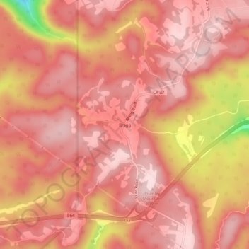
Name: Bragg topographic map, elevation, terrain.

Location: Bragg, Raleigh County, West Virginia, United States (37.76234 -81.01037 37.80234 -80.97037)

Average elevation: 2,726 ft

Minimum elevation: 1,995 ft

Maximum elevation: 2,946 ft

Raleigh County trails, hiking, mountain biking, running and outdoor activities

Gear up for your next adventure:

🎒Trekking Poles - Sturdy poles for balance and stability on rough terrain
🧣Hiking Neck Gaiter - Multi‑use neck protection for outdoor weather
🔋Solar Power Banks - Keep your GPS and phone charged in remote wilderness areas
🔥Plasma Lighters - Windproof lighters that work in any weather condition
🔭Compact Binoculars - HD vision for scouting terrain and identifying distant landmarks

As an Amazon Associate, this site earns from qualifying purchases at no extra cost to you.