Geolocate

Deltona topographic map

Click on the map to display elevation.

About this map

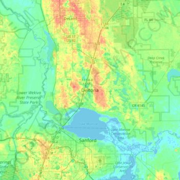
Name: Deltona topographic map, elevation, terrain.

Location: Deltona, Volusia County, Florida, 32725, United States (28.74054 -81.42367 29.06054 -81.10367)

Average elevation: 39 ft

Minimum elevation: -10 ft

Maximum elevation: 121 ft

Volusia County trails, hiking, mountain biking, running and outdoor activities

Other topographic maps

Click on a map to view its topography, its elevation and its terrain.

Lorraine Lake

United States > Florida > Volusia County > Deltona

Average elevation: 66 ft

Gear up for your next adventure:

🧥Men's Rain Shells - Premium waterproof and breathable jackets for mountain weather
🪶Camping Sleeping Pad - Comfortable sleeping pad for backpacking
🪵Folding Camp Saw - Compact saw for wood and campsite work
🔭Telescopic Hiking Pole - Adjustable pole for hiking stability
📶Satellite Messenger - Communication device off‑grid

As an Amazon Associate, this site earns from qualifying purchases at no extra cost to you.