Geolocate

Little Baddow topographic map

Click on the map to display elevation.

About this map

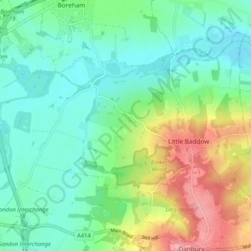
Name: Little Baddow topographic map, elevation, terrain.

Location: Little Baddow, Chelmsford, Essex, England, United Kingdom (51.72186 0.52134 51.75589 0.59513)

Average elevation: 138 ft

Minimum elevation: 30 ft

Maximum elevation: 371 ft

Other topographic maps

Click on a map to view its topography, its elevation and its terrain.

Danbury

United Kingdom > England > Chelmsford > Danbury

Average elevation: 203 ft

Gear up for your next adventure:

❄️Traction Cleats - Prevent slips on icy trails during winter hikes
📦Gear Storage Bags - Organize and protect outdoor equipment
🏔️Mountain Trail Maps - High‑detail maps for popular peaks
📷Action Camera - Capture your outdoor adventures in HD
🔋Rechargeable Batteries - Power up your outdoor devices

As an Amazon Associate, this site earns from qualifying purchases at no extra cost to you.