
Thank you for supporting this site ❤️
Make a donation
Make a donation
Gear up for your next adventure:
As an Amazon Associate, this site earns from qualifying purchases at no extra cost to you.
Peraboa topographic map
Click on the map to display elevation.
Thank you for supporting this site ❤️
Make a donation
Make a donation
Gear up for your next adventure:
As an Amazon Associate, this site earns from qualifying purchases at no extra cost to you.
About this map
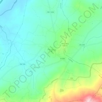
Name: Peraboa topographic map, elevation, terrain.
Location: Peraboa, Covilhã, Castelo Branco, 6200-591, Portugal (40.23596 -7.40751 40.27596 -7.36751)
Average elevation: 1,617 ft
Minimum elevation: 1,385 ft
Maximum elevation: 2,277 ft
Thank you for supporting this site ❤️
Make a donation
Make a donation
Gear up for your next adventure:
As an Amazon Associate, this site earns from qualifying purchases at no extra cost to you.