Geolocate

Yarnscombe topographic map

Click on the map to display elevation.

About this map

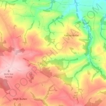
Name: Yarnscombe topographic map, elevation, terrain.

Location: Yarnscombe, Torridge District, Devon, England, United Kingdom (50.96042 -4.09751 51.01031 -4.03279)

Average elevation: 423 ft

Minimum elevation: 85 ft

Maximum elevation: 679 ft

Other topographic maps

Click on a map to view its topography, its elevation and its terrain.

Woodacott

United Kingdom > England > Devon > Torridge District > Thornbury

Average elevation: 453 ft

Chilsworthy

United Kingdom > England > Devon > Torridge District

Average elevation: 456 ft

Riddlecombe

United Kingdom > England > Devon > Torridge District

Average elevation: 512 ft

Derril

United Kingdom > England > Devon > Torridge District > Pyworthy

Average elevation: 417 ft

Ashmill

United Kingdom > England > Devon > Torridge District > Ashwater

Average elevation: 512 ft

Stoke

United Kingdom > England > Devon > Torridge District > Hartland

Average elevation: 249 ft

Appledore

United Kingdom > England > Devon > Torridge District

Average elevation: 69 ft

Clawton

United Kingdom > England > Devon > Torridge District

Average elevation: 420 ft

Westward Ho!

United Kingdom > England > Devon > Torridge District

Average elevation: 72 ft

Stibb Cross

United Kingdom > England > Devon > Torridge District

Average elevation: 515 ft

Diddywells

United Kingdom > England > Devon > Torridge District > Northam

Average elevation: 62 ft

Earthquake

United Kingdom > England > Devon > Torridge District

Average elevation: 115 ft

Taddiport

United Kingdom > England > Devon > Torridge District

Average elevation: 279 ft

Hollocombe

United Kingdom > England > Devon > Torridge District

Average elevation: 489 ft

Horns Cross

United Kingdom > England > Devon > Torridge District

Average elevation: 367 ft

Gear up for your next adventure:

🪶Fire Starter Kit - Reliable fire starter for survival and camping
🧺Microfiber Travel Towels - Compact and fast-drying towels for trail use
🪶Survival Guide Book - Expert advice for emergency preparedness
🧣Hiking Neck Gaiter - Multi‑use neck protection for outdoor weather
🥇GPS Hiking Watch - Multi‑sport GPS watch with navigation and trail tracking

As an Amazon Associate, this site earns from qualifying purchases at no extra cost to you.