
Thank you for supporting this site ❤️
Make a donation
Make a donation
Gear up for your next adventure:
As an Amazon Associate, this site earns from qualifying purchases at no extra cost to you.
Pinnawala topographic map
Click on the map to display elevation.
Thank you for supporting this site ❤️
Make a donation
Make a donation
Gear up for your next adventure:
As an Amazon Associate, this site earns from qualifying purchases at no extra cost to you.
About this map
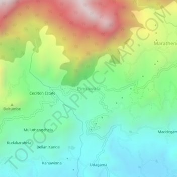
Name: Pinnawala topographic map, elevation, terrain.
Location: Pinnawala, Ratnapura District, Sabaragamuwa Province, Sri Lanka (6.71074 80.65455 6.75074 80.69455)
Average elevation: 3,248 ft
Minimum elevation: 1,719 ft
Maximum elevation: 6,135 ft
Thank you for supporting this site ❤️
Make a donation
Make a donation
Gear up for your next adventure:
As an Amazon Associate, this site earns from qualifying purchases at no extra cost to you.