
南涧县 topographic map
Interactive map
Click on the map to display elevation.
About this map
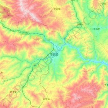
Name: 南涧县 topographic map, elevation, terrain.
Location: 南涧县, 南涧彝族自治县, 大理白族自治州, 云南省, 中国 (24.88316 100.35455 25.20316 100.67455)
Average elevation: 6,532 ft
Minimum elevation: 4,167 ft
Maximum elevation: 9,902 ft
Other topographic maps
Click on a map to view its topography, its elevation and its terrain.