
Thank you for supporting this site ❤️
Make a donation
Make a donation
Gear up for your next adventure:
As an Amazon Associate, this site earns from qualifying purchases at no extra cost to you.
Capranica-Scalo topographic map
Click on the map to display elevation.
Thank you for supporting this site ❤️
Make a donation
Make a donation
Gear up for your next adventure:
As an Amazon Associate, this site earns from qualifying purchases at no extra cost to you.
About this map
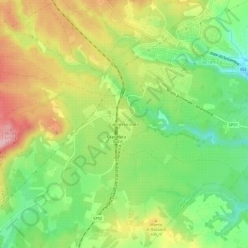
Name: Capranica-Scalo topographic map, elevation, terrain.
Location: Capranica-Scalo, Capranica, Viterbo, Lazio, 01012, Italia (42.22642 12.13885 42.26642 12.17885)
Average elevation: 1,299 ft
Minimum elevation: 1,020 ft
Maximum elevation: 1,644 ft
Thank you for supporting this site ❤️
Make a donation
Make a donation
Gear up for your next adventure:
As an Amazon Associate, this site earns from qualifying purchases at no extra cost to you.