Geolocate

Valley Center topographic map

Click on the map to display elevation.

About this map

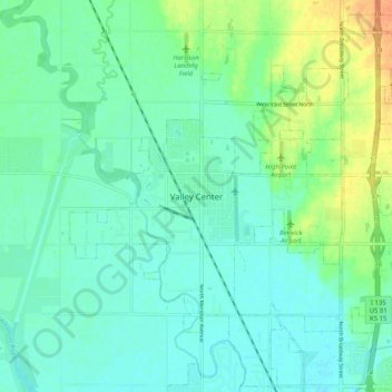
Name: Valley Center topographic map, elevation, terrain.

Location: Valley Center, Sedgwick County, Kansas, United States (37.79473 -97.41338 37.87473 -97.33338)

Average elevation: 1,362 ft

Minimum elevation: 1,329 ft

Maximum elevation: 1,447 ft

Sedgwick County trails, hiking, mountain biking, running and outdoor activities

Gear up for your next adventure:

🧷Carabiner Set - Durable clips for gear attachment
🧢Outdoor Hiking Hat - Sun protection hat for outdoor explorers
🌡️Portable Weather Meter - Track weather conditions on the trail
🪶Camping Sleeping Pad - Comfortable sleeping pad for backpacking
🪶Compact Camp Shovel - Folding shovel for campsite tasks

As an Amazon Associate, this site earns from qualifying purchases at no extra cost to you.