
Thank you for supporting this site ❤️
Make a donation
Make a donation
Gear up for your next adventure:
As an Amazon Associate, this site earns from qualifying purchases at no extra cost to you.
Cumin topographic map
Click on the map to display elevation.
Thank you for supporting this site ❤️
Make a donation
Make a donation
Gear up for your next adventure:
As an Amazon Associate, this site earns from qualifying purchases at no extra cost to you.
About this map
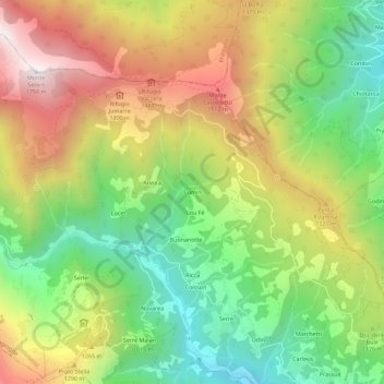
Name: Cumin topographic map, elevation, terrain.
Location: Cumin, Angrogna, Turin, Piémont, 10065, Italie (44.84445 7.18811 44.88445 7.22811)
Average elevation: 3,675 ft
Minimum elevation: 2,024 ft
Maximum elevation: 5,715 ft
Thank you for supporting this site ❤️
Make a donation
Make a donation
Gear up for your next adventure:
As an Amazon Associate, this site earns from qualifying purchases at no extra cost to you.