
Thank you for supporting this site ❤️
Make a donation
Make a donation
Gear up for your next adventure:
As an Amazon Associate, this site earns from qualifying purchases at no extra cost to you.
Petalaca topographic map
Click on the map to display elevation.
Thank you for supporting this site ❤️
Make a donation
Make a donation
Gear up for your next adventure:
As an Amazon Associate, this site earns from qualifying purchases at no extra cost to you.
About this map
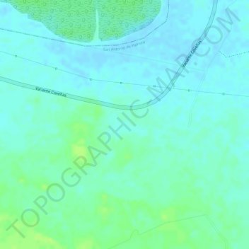
Name: Petalaca topographic map, elevation, terrain.
Location: Petalaca, Palmito, Morrosquillo, Sucre, Colombia (9.37181 -75.63537 9.39181 -75.61537)
Average elevation: 20 ft
Minimum elevation: -3 ft
Maximum elevation: 46 ft
Thank you for supporting this site ❤️
Make a donation
Make a donation
Gear up for your next adventure:
As an Amazon Associate, this site earns from qualifying purchases at no extra cost to you.