Geolocate

Huaca topographic map

Click on the map to display elevation.

About this map

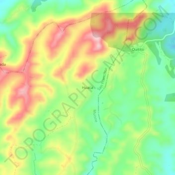
Name: Huaca topographic map, elevation, terrain.

Location: Huaca, San Francisco, Muisne, Esmeraldas, Ecuador (0.75395 -80.03021 0.79395 -79.99021)

Average elevation: 574 ft

Minimum elevation: 266 ft

Maximum elevation: 948 ft

Gear up for your next adventure:

🎒Day Hiking Backpack - Lightweight backpack perfect for day trips and outdoor adventures
📌Outdoor GPS Map App - Apps and devices for digital topographic navigation
🌡️Portable Weather Meter - Track weather conditions on the trail
🪶Camp Gear Gift Set - Perfect gift bundle for outdoor fans
🪶Wildlife Field Guides - Learn animal tracking and species ID

As an Amazon Associate, this site earns from qualifying purchases at no extra cost to you.