
Make a donation
Gear up for your next adventure:
As an Amazon Associate, this site earns from qualifying purchases at no extra cost to you.
Rooskey topographic map
Click on the map to display elevation.
Make a donation
Gear up for your next adventure:
As an Amazon Associate, this site earns from qualifying purchases at no extra cost to you.
About this map
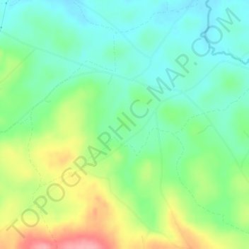
Name: Rooskey topographic map, elevation, terrain.
Average elevation: 436 ft
Minimum elevation: 312 ft
Maximum elevation: 669 ft
Make a donation
Gear up for your next adventure:
As an Amazon Associate, this site earns from qualifying purchases at no extra cost to you.
Other topographic maps
Click on a map to view its topography, its elevation and its terrain.
Loughmacrory
United Kingdom > Northern Ireland > County Tyrone > Loughmacrory
Average elevation: 623 ft
Clonfeacle (Tyrone portion)
United Kingdom > Northern Ireland > County Tyrone > Moygashel
Average elevation: 203 ft
Make a donation
Gear up for your next adventure:
As an Amazon Associate, this site earns from qualifying purchases at no extra cost to you.