Geolocate

Santa Ana topographic map

Click on the map to display elevation.

About this map

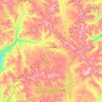
Name: Santa Ana topographic map, elevation, terrain.

Location: Santa Ana, Province of Castrovirreyna, Huancavelica, Peru (-13.25489 -75.25657 -12.91419 -74.98896)

Average elevation: 15,325 ft

Minimum elevation: 12,671 ft

Maximum elevation: 17,306 ft

Other topographic maps

Click on a map to view its topography, its elevation and its terrain.

Caymo

Peru > Huancavelica > Salcabamba

Average elevation: 10,233 ft

Palermo

Peru > Huancavelica > El Carmen

Average elevation: 12,165 ft

Los Andes

Peru > Huancavelica

Average elevation: 13,684 ft

Yanacocha

Peru > Huancavelica

Average elevation: 11,378 ft

Gear up for your next adventure:

🔭Compact Binoculars - HD vision for scouting terrain and identifying distant landmarks
🧭Pro Hiking Compasses - High-accuracy liquid-filled compasses for topographic orientation
🪶LED Camping Lantern - Bright lantern for camp lighting
Backpacking Tents - Weight-optimized shelters for multi-day topographic surveys
🔥Camping Stove - Portable stove for camping and backcountry cooking

As an Amazon Associate, this site earns from qualifying purchases at no extra cost to you.