Geolocate

Edgemont topographic map

Click on the map to display elevation.

About this map

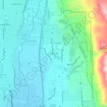
Name: Edgemont topographic map, elevation, terrain.

Location: Edgemont, Provo, Utah County, Utah, 84602, United States (40.26607 -111.67187 40.30607 -111.63187)

Average elevation: 5,046 ft

Minimum elevation: 4,639 ft

Maximum elevation: 6,775 ft

Utah County trails, hiking, mountain biking, running and outdoor activities

Gear up for your next adventure:

😴Insulated Sleeping Pads - Compact and warm pads for high-elevation camping
🧣Merino Neck Gaiters - Multi-functional headwear for wind and sun protection
🔌USB Car Charger - Car charger for on‑the‑go power needs
🔭Telescopic Hiking Pole - Adjustable pole for hiking stability
🏫Relief Map Kits - Hands-on tools for teaching landforms and elevation

As an Amazon Associate, this site earns from qualifying purchases at no extra cost to you.