
Make a donation
Gear up for your next adventure:
As an Amazon Associate, this site earns from qualifying purchases at no extra cost to you.
Monte Barro topographic map
Click on the map to display elevation.
Make a donation
Gear up for your next adventure:
As an Amazon Associate, this site earns from qualifying purchases at no extra cost to you.
Monte Barro
Il monte Barro o monte di Galbiate (in lombardo Barr) è un monte isolato nelle Prealpi Lombarde con un'altitudine di 922 m s.l.m.
Make a donation
Gear up for your next adventure:
As an Amazon Associate, this site earns from qualifying purchases at no extra cost to you.
About this map
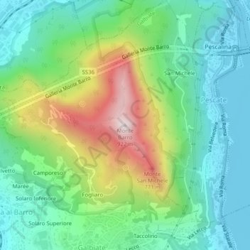
Name: Monte Barro topographic map, elevation, terrain.
Location: Monte Barro, Galbiate, Lecco, Lombardia, 23851, Italia (45.83074 9.38016 45.83084 9.38026)
Average elevation: 1,348 ft
Minimum elevation: 646 ft
Maximum elevation: 2,894 ft
Make a donation
Gear up for your next adventure:
As an Amazon Associate, this site earns from qualifying purchases at no extra cost to you.