Geolocate

El Espinal topographic map

Click on the map to display elevation.

About this map

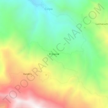
Name: El Espinal topographic map, elevation, terrain.

Location: El Espinal, Sayapullo, Gran Chimú, La Libertad, Perú (-7.59041 -78.46058 -7.55041 -78.42058)

Average elevation: 7,402 ft

Minimum elevation: 5,541 ft

Maximum elevation: 9,934 ft

Gear up for your next adventure:

🥇GPS Hiking Watch - Multi‑sport GPS watch with navigation and trail tracking
🥤Water Filter Bottle - All‑in‑one filter bottle for safe hydration
🎒Outdoor Daypacks - Lightweight backpacks designed for carrying maps and essential gear
🧦Merino Wool Socks - Moisture-wicking, blister-preventing socks for long treks
🥄Camping Utensil Set - Lightweight utensils for outdoor meals

As an Amazon Associate, this site earns from qualifying purchases at no extra cost to you.