
Thank you for supporting this site ❤️
Make a donation
Make a donation
Gear up for your next adventure:
As an Amazon Associate, this site earns from qualifying purchases at no extra cost to you.
Arrochela topographic map
Click on the map to display elevation.
Thank you for supporting this site ❤️
Make a donation
Make a donation
Gear up for your next adventure:
As an Amazon Associate, this site earns from qualifying purchases at no extra cost to you.
About this map
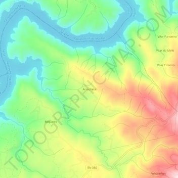
Name: Arrochela topographic map, elevation, terrain.
Location: Arrochela, Pedrógão Pequeno, Sertã, Castelo Branco, Portugal (39.91049 -8.11482 39.95049 -8.07482)
Average elevation: 1,332 ft
Minimum elevation: 860 ft
Maximum elevation: 2,060 ft
Thank you for supporting this site ❤️
Make a donation
Make a donation
Gear up for your next adventure:
As an Amazon Associate, this site earns from qualifying purchases at no extra cost to you.